|
|
 |
|
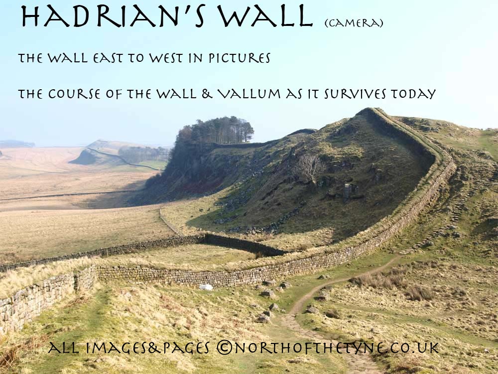
Page IV
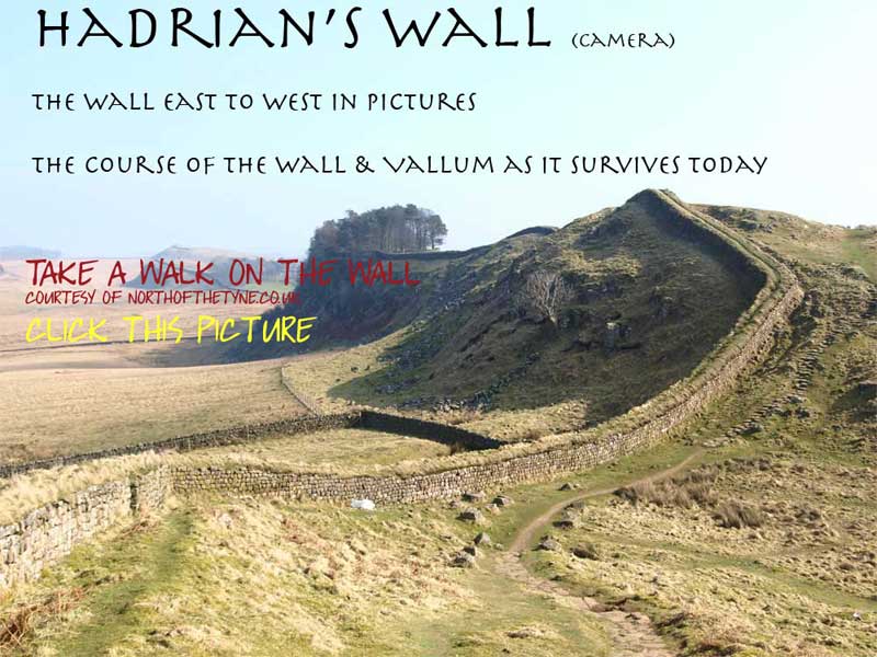
Heddon on the Wall to Harlow Hill
Milecastles 12 to 16
|
|
|
 |
 |
|
 |
|
|
|
 |
|
 |
|
|
|
|
Heddon on the Wall to Harlow Hill
From Heddon the Wall continues west now finally clear of anything that might be considered " Built-up Area" and for the most part, in this section, under the Military Road. with the Vallum and Defensive Ditch on view to north and south.
This road was proposed by General Wade following his inability to move his heavy artillery accross the country to Carlisle in 1745 when with his troops in Newcastle, Charles Edward Stuart (Bonnie Prince Charlie) brought his army down the west side of the country. At that time only the Low Road was available to Wade along the banks of the River Tyne and he resolved that no English army would be inconvenieced in the same way in the future.
To create the hard standing for his road Wade in his plan had the Wall demolished where it was required.
Wade never lived to see the road built, dying in 1748 before the work commenced in 1752.
Vindobala
The name given to the fourth Fort on the Wall in the Notitia. another Cavalry fort with one third protruding northward from the line of the Wall. The area be in 4 and a half acres.
Roman Mile = 1620 yards = 0.92Mile = 1.48km

Start point for this page
|
|
 |
|
|
Location
|
Milecastle
|
|
Segedunum to Pons Aelis
|
|
|
Pons Aelis to Condercum
|
|
|
Condercum to Heddon
|
|
|
Heddon to Harlow Hill
|
|
|
Harlow Hill to Portgate
|
|
|
Portgate to Chesters
|
|
|
Chesters to Brocolitia
|
|
|
Brocolitia to Vercovicivm
|
|
|
Vercovicivm to MC40
|
|
|
MC40 to Aesica
|
|
|
Aesica to Carvoran
|
|
|
Carvoran to Birdoswald
|
|
|
Birdoswald to Hare Hill
|
|
|
Hare Hill to Newton
|
|
|
Newton to Stanwix
|
|
|
Stanwix to Dykesfield
|
|
|
Dykesfield to Maia
|
|
|
|
|
|
|
|
|
|
|
|
|
|
|
|
 |
|
|
|
|
|
|
|
 |
<<<<<<<< One of interesting features in this length of the Broad Wall , given to the Society of antiquities of Newcastle by Sir James Knott Bart. in 1924, is the curious circular chamber built into the thickness of the Wall. This was discovered by John Clayton about 1883. It is of post-Roman date and is probably the base of a Medieval kiln *1.
See below the shape of the facing stones.
|
|
|
|
|
|
|
|
|
 |
 |
|
<<<<<<<<<< The site of Milecastle 12
Town Farm. Heddon on the Wall
|
 |
|
|
|
|
|
|
|
The Wall leaves Heddon down the bank, through this skip graveyard through the forcourt of the petrol station beyond to the junction in front of the Three Tuns public house and continues directly onto the Military Road.
Needless to say the Hadrian's Wall Walk doesn't come this way!
|
|
|
|
|
|
|
|
|
|
|
 |
|
 |
|
The line of the Wall is for the next considerable number of miles under the Military Road This road the brainchild of General George Wade (1690-1748) famous for building military roads and installations in Scotland.
|
|
|
|
|
|
|
 |
 |
|
 |
|
 |
|
To the south of this stretch the Vallum can be seen in the fields.
Over the wall to the north the Ditch runs tight to the road and the road sits on the Wall.
****
pictures below
|
|
|
|
|
 |
|
 |
|
 |
 |
|
|
 |
 |
 |
|
To accommodate the Heddon bypassthe main A69 trunk road was taken through the line of the Military Road and hence the line of the Wall. The Hadrian's Wall footpath takes the diversion over the main road.
The old road exists but it is not a footpath it is certainly not to be undertaken by walkers.
I show the line of the wall as it exists for this site.
|
|
|
|
|
 |
 |
|
|
The site of Milecastle 13
150 metres from the bend back on the Military Road beyond the Rudchester Burn which flows under the road and the flyover.
|
|
|
|
|
 |
|
|
|
|
|
 |
|
|
 |
|
 |
|
|
 |
|
|
 |
|
|
|
 |
 |
|
|
|
From Milecastle 13 the wall proceeds up a gentle rise to Vindobala Fort.
|
|
|
|
|
|
|
|
|
VINDOBALA FORT
The fourth fort from the east on the line lies 6.75 miles from Condercum is now reduced to bumps in the grass surrounding the Farm at Rudchester.
Another Cavalry Fort it was known in the fourth century to have been garrisoned by the First Cohort of Frisiavones the name of a tribe from what is now the Netherlands. towards the end of the second century it was burned down but afterwards rebuilt. A century later it was abandoned for reasons unknown, and about 370 Ad it was re-occupied and restored and continued in occupation for a long time.*2
In the Notitia it is called Vindobala, in the Ravenna list it is called Vindovala
*******************
Mentioned by Camden but the fort was first described by Robert Smith, 1708 " On the south side of the Wall, are visible ruins of a large square Roman Castle, with foundations of several houses in the middle of the area...........this also has a Vallum round it, and joins colse to the wall......."
The last account before the military road was built was by Horsley in his Brittania Romana in 1732. ".......On the north side there have been six turrets, one at each corner, one on each side of the gate and one between each corner and those adjoining to the gate...........".
William Hutton, of whom more later, in 1801 describes"......What remains is a close, joining the road, of five acres, now in grass, and eminently situated; carries the strong marks of former buildings,and still stonger of its ramparts. The platform of this grand station is complete. I have all along inquired for turrets; but might as well have inquired among the stars. I was given to understand, that part of one was remaining here......"
|
 |
|
This Fort in the fashion of the Cavalry Forts had one third of the fort north of the line of the Wall as seen in the diagram above.
|
|
|
|
 |
|
 |
|
Wide views of Vindobala Fort click for bigger picture
Top - Southern side ************ Bottom - North side
|
|
 |
|
|
 |
|
 |
|
West of Vindobala the wall continues arrow straight. It drops to cross the March Burn and just beyond the Burn at the site of Milecastle 14 it pivots to the left towards Eppies Hill
|
|
|
|
|
 |
|
<<<<<<<<<< The site of Milecastle 14
One third of a mile beyond Rudchester
marked by an old field gatepost
|
|
|
|
|
|
|
|
|
|
|
|
|
|
|
|
 |
 |
 |
|
 |
|
 |
|
|
|
At the top of Eppies Hill while not indicated on the OS map there must have been a Turret (14a) the site is commanding and the wall with a slight turn to the right heads directly to Harlow Hill passing the position of Milecaste No. 15 on its way to Milecastle No.16.
The Vallum at Turret 14a is as close to the wall as encounterd anywhere else some 50 yards, and from here the Vallum takes a more direct route west to be some 400 yards south of the high ground at Milecastle No. 16
|
|
|
|
|
|
 |
 |
|
The Vallum and the Ditch at Eppies Hill Turret 14a
****
<<<<<<<< pictures
|
|
|
|
|
|
|
|
|
|
|
|
 |
 |
|
 |
|
|
|
|
<<<<<<<<<< The site of Milecastle 15
At a farm gateway.
Many of the Wall's Milecastle locations are identifiable by farm gateways the firm ground of the milecastles themselves and the approach road to the sites from the Roman Military Way providing hard standing over the millennia
|
|
 |
|
 |
|
 |
 |
|
|
|
 |
The Vallum to the south of Milecastle 16
****
A damp soft sided ditch very identifable as Vallum
<<<<<<<< pictures
|
|
|
 |
|
|
|
|
|
|
|
|
|
|
 |
|
 |
At Harlow Hill the main road makes a little deviation right and left to pass the site of Milecastle 16 which is to the top of the hill on the left.
The Wall however went straight to the top following the line from Eppies Hill.
|
|
|
|
|
|
 |
 |
|
 |
 |
|
|
|
|
|
<<<<<<<<<< The site of Milecastle 16
In a farm field in Harlow Hill
|
|
|
|
|
|
 |
|
|
The Wall continues to Milecastle 22 via Hunnum Fort.
next page >>>>>>>>>
|
|
References for page 4
*1 Issued by Northumberland County History Committee -The Roman Frontier from Wallsend to Rudchester Burn 1930
*2 Frank Graham - The Roman Wall 1979 Pg 46 and engraved map of Vidobala Pg 47
|
|
|
|
 |
|
|
|
|
|
 |
Milecastles
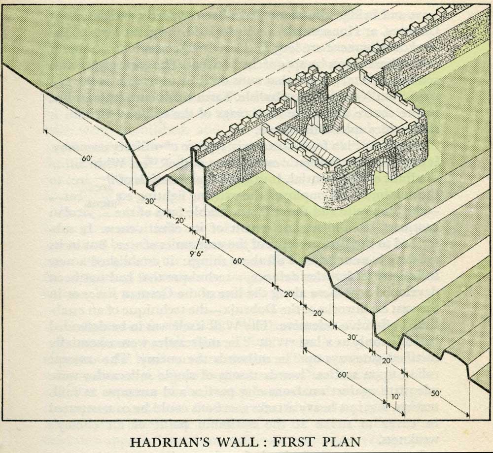
This first plan provided for a wall 10ft wide, 15ft 6 inches high and surmounted by a 6ft crenellation. to the north of this was a 20 ft berm, a standard fighting ditch 30ft by 13ft 6 inches, and a glacis composed of the spoil of the ditch, approximately 60ft in width.
At each Roman mile was a milecastle with a north gate opening through the Wall, surmounted by a defensive turret and a south gate. In the original plan there were two barracks and the milecastle maintained a turret on either hand for the patrol garrison.
South of the wall was the Vallum, a complex consisting of a 20 ft ditch with a wide bottom section and mounds composed of spoil to north and south. The wall was built to the design width only on the eastern slope. The Milecastles built before the change of plan had 10ft wings on either side. The curtain wall as finally built was substantially narrower and the join is indicated in the diagram.
This information and the diagram taken from Richard Devine The Northwest Frontier of the Roman Empire Chap2 pg 27 (published macdonald 1969)
|
|
|
|
|
|
|
|
|
|
 |
 |
|
|
|
|
|
|
|
|
|
|
|
|
|
|
|
|
|
|
|
|
|
|
|
|
|
|
|
|
|
|
|
|
|
|
|
|
|
|
|
|
|
|
|
|
|
|
|
|
|
|
|
|
|
|
|
|
|
|
|
|
|
|
|
|
|
|
|
|
|
|
|
|
|
|
|
|
|
|
|


