 |
|
||||||||||||||||||||||||||||||||||||||
|
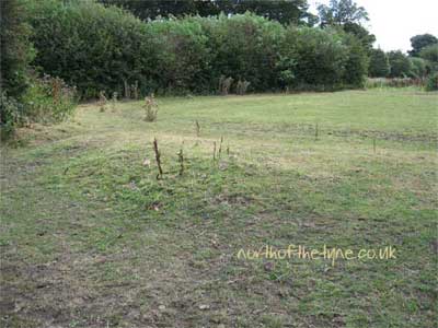
Little or No Trace Castles (16) These Traces are mostly Grassy mounds or have been completely built over or dispersed and I feel that that they hardly warrant a page to themselves. I have given the OS Reference by way of directions. For their histories see below |
|||||||||||||||||||||||||||||||||||||||
|
|||||||||||||||||||||||||||||||||||||||
| Bellingham Castle
Location Landranger sheet 80
NY 841 833 Off the Redesmouth road in Bellingham village |
 |
 |
|||||||||||||||||||||||||||||||||||||
| Capheaton Castle
Location Landranger sheet 81
NZ 039 804 in grounds of Capheaton Hall Photo ©Keith Ascough |
 |
 |
|||||||||||||||||||||||||||||||||||||
| Eshott Castle
Location Landranger sheet 81
NZ 201 986 in fields through Eshott village |
 |
 |
|||||||||||||||||||||||||||||||||||||
| Fenham Castle
Location Landranger sheet 75
NU 084 408 On coastal land near Holy Island |
 |
 |
|||||||||||||||||||||||||||||||||||||
| Hirst Castle
Location Landranger sheet 81
NZ 281 878 In a Housing estate in Ashington |
 |
 |
|||||||||||||||||||||||||||||||||||||
 |
|||||||||||||||||||||||||||||||||||||||
| Hirst Castle C 1908 Mr. Jim Davison | |||||||||||||||||||||||||||||||||||||||
| Horton Castle (Chatton)
Location Landranger sheet 75
NU 027 308 Behind West Horton House considered to be trace of tower |
 |
 |
|||||||||||||||||||||||||||||||||||||
 |
|||||||||||||||||||||||||||||||||||||||
 |
|||||||||||||||||||||||||||||||||||||||
|
Horton Castle 1725 (Buck) |
|||||||||||||||||||||||||||||||||||||||
| Low Horton Castle
Location Landranger sheet 88
NZ 282 797 Now the Site of a farmhouse near Blyth |
 |
 |
|||||||||||||||||||||||||||||||||||||
| Nafferton Castle
Location Landranger sheet 88
NZ 073 658 In woodland off the A 69 at Whittle Burn |
 |
 |
|||||||||||||||||||||||||||||||||||||
| Otterburn Castle
Location Landranger sheet 80
NY 887 931 In the grounds of Otterburn Tower Hotel |
 |
 |
|||||||||||||||||||||||||||||||||||||
| Seaton Delaval Castle
Location Landranger sheet 88
NZ 321 765 In a farmyard next to Seaton Deleval Hall |
 |
 |
|||||||||||||||||||||||||||||||||||||
| Sewingshields Castle
Location Landranger sheet 87
NY 811 706 North of Sewingshields Farm in a field |
 |
 |
|||||||||||||||||||||||||||||||||||||
| Shawdon Castle
Location Landranger sheet 81
NU 092 143 Shawdon Hall is built on the site A private residence |
 |
 |
|||||||||||||||||||||||||||||||||||||
| Titlington Castle
Location Landranger sheet 81
NU 099 151 In the Garden of Titlington Hall A private residence |
 |
 |
|||||||||||||||||||||||||||||||||||||
| Tweedmouth Castle
Location Landranger sheet 75
NT 992 531 On the south bank of the Tweed opposite Berwick on Tweed Castle |
 |
 |
|||||||||||||||||||||||||||||||||||||
| Widdrington Castle
Location Landranger sheet 81
NZ 255 958 In a field behind the church at Widdrington |
 |
 |
|||||||||||||||||||||||||||||||||||||
 |
|||||||||||||||||||||||||||||||||||||||
|
Click print for large image Widdrington Castle 1725 (Buck) with thanks to A.Rowland |
|||||||||||||||||||||||||||||||||||||||
| Whitley Castle
Location Landranger sheet 88
NZ 357 714 In the Area of Marden Country Park ? |
 |
 |
|||||||||||||||||||||||||||||||||||||
|
Histories Bellingham:- NY 841833/Traces Bellingham is a small market town on the North TyneBellingham Castle was probably an early C12 Motte and Bailey castle, built by the Bellingham family. All traces of the stone castle had disappeared by the late C13 leaving only the mound. (Jackson writes towerhouse site) First mentioned 1263. A mound at the east end of Bellingham is all that remains of the former motte and bailey castle. It was probably built in C12 by the Bellingham family and is likely to have been replaced by a stone castle in C13. The existence of a castle here is suggested by documentary evidence which reports that William de Bellingham, sheriff of Tynedale and Forester of Tynedale under the king of Scotland, had his seat at Bellingham. The mound, near the Harelaw burn and close to the mill from which in 1263 a huge rent of 10 pounds was paid yearly, is topped by a smaller mound and, because the top of this feature is quite small, doubt has been expressed about the form of the castle if it was situated here; it has also been suggested that the whole mound is a natural feature. Back to Images Capheaton :- NZ 039804/No trace/ A fortalice is mentioned in 1415, and described as a "fair castle" in 1538 (Bates 1891). It was moated, and had a drawbridge. The present house was built, a little to the east, in 1668 (Hodgson 1827). There are no visible remains of the 'castle' (probably a tower),and its site is in some doubt. The present owner states that traditionally it stood south of the Hall (position published), whereas Hodgson and later writers record it as being to the west. The Charltons led the Croziers here in 1543 to fire both the Village and the Tower. The Tower was repairable. Permission was granted in 1668 for a new mansion on or around the site of the original castle. Also known as Hutton; Kippetheton; Kippitheton. in the parish of Capheaton. Back to Images (Image 2018) Eshott:- NZ 201986/Ruin/Access Eshott Castle was first recorded in 1415, though there was a fortified manor house was licensed in 1310. The ruins of the castle lie on low lying ground near the junction of two streams. The remains of the moats can be seen surrounding the remains of a wall and possibly three stone towers. No trace remains of any other buildings. The original licence to crenellate was given in 1310 to Sir Roger Mauduit, but in 1358 it was taken from him because he was a rebel against the crown, and handed over to his son. Back to Images Fenham:-NU 084408/Traces/Access Benedictine grange or manor house of Lindisfarne Priory, built or added to in 1339 AD, with a moat or a ditch in 1385 AD. A tower was standing in 1560 AD. Now just a mound surrounded by the remains of a precinct wall and ditch and a series of enclosures thought to contain the remains of service and agricultural buildings, crofts and tofts, the remains of medieval agricultural systems and part of a mill race. Some sources suggests this as site of a small motte and bailey of late C11 date. Although this is a manorial centre there doesn't seem to be any evidence for this suggestion. The Tower is certain; the castle is questionable. Also known as, or recorded in historical documents as; Fenham Mill Back to Images Hirst :- NZ 281878/No trace/ ATower stood at Hirst in medieval times. Old documents suggest that it was built by Ralph, the third Lord Ogle in the late C15 or early C16. A manor house next to it is thought to have been built by Thomas Errington in C17. The 1715 Survey records " North Hurst ... 'in which is 2 ancient piles, ye one belonging to ye Dutches of Newcastle and ye other to one Johnson, both formerly possest by ye Withringtons' " However, the tower was demolished in 1916 and the site has been built over. The tower stood in what was are now the eastern suburbs of Ashington on the north side of Woodhorn Road at that time a charming country lane. Hurst; Back to Images Horton (Chatton):-NU 027308/Traces/Private House, Access on request There are fragments incorporated into the once farmhouse that is now West Horton House, Horton Castle was the castle of "Horton in Glendall" first mentioned in a list of castles from 1415 when it was owned by Sir thomas Gray, and in 1542 it was described as a 'great tower the chief house of Sir Roger Gray. By 1715 it was in a ruined state, though it was repaired and from 1740 to 1808 was used as a house. It was finally demolished in the early C19. Nothing can be seen at the site today except for a few fragments of worked stone. PastScape record reads ”Site of a tower house and barmkin, recorded in a survey of 1415. A further survey, dating from 1542, refers to a great tower with a barmkin. It was rebuilt between 1568 and 1674, a drawing of 1728 depicting a a high wall with corner turrets enclosing a garden with a roofless ruin, that is a fortified manor house. The buildings were demolished in 1808, and the stone used to build West Horton Farm which now stands at the foot of the knoll on which the tower house once stood.”Back to Images Low Horton:- NZ 282797/Traces/Access Fortified Manor House, licence to crenellate of 1292 granted to Sir Guischard de Charron (or Charrum). Edward I stayed here in that year and again in 1301 and 1304. (The licence means this was a stone building, is this an early C14 use of pele to mean a stone building? Most early uses of pele tend to mean timber buildings and it's use for small tower houses is supposed to be modern, although the term 'pelehouse' for bastles is used C16.) The course of a moat can be traced. Called pelum in 1317-18 and fortalicium in 1415. In the 1415 list "Horton juxta mare" is noted as being held by William de Winchester although he had died in 1405. Passing through a number of ownerships, the Castle was last occupied by two sisters of Admiral George Deleval who died in 1723. Dismantled in 1809. A farm lies on the site.Back to Images Nafferton:- NZ 073658/Traces/Access The remains of an enclosure castle and a later tower house, situated on the western edge of the steeply incised Whittle Burn. The castle is visible as substantial rectangular enclosure, which measures a maximum of 45m by 7m within a rampart 6m wide and a ditch 10m wide on the northern and western sides; the eastern side of the enclosure is afforded natural defence by the steep slopes above the Whittle Burn and the south side is defended by a natural ravine. Documents record the existence of a castle at the site by 1218, when its owner Philip de Ulecotes was ordered to demolish a new wooden tower which was being constructed without licence. In 1221 the tower, which was still standing, was ordered by the King to be dismantled and its timbers were removed to build a new gaol at Newcastle-upon-Tyne. The defensive earthwork enclosure remained. Within the south western corner of the enclosure there are the remains of a stone built tower house thought to be of C15 or C16 date. The site was held during Edward I reign by the Feltons but was not then in use, although the locally celebrated Lang Lonkins is said to have had a hideout here at a later date. The OS Explorer map 316 shows the site as Lonkin's hall.Back to List Back to Images Otterburn:-NY 887931/NoTrace/Access The Castle has vanished. It was built bt the de Umfravilles close to the burn. The "capital messuage" mentioned here in 1308 was described as 'very strong' in 1388 when it withstood a Scottish siege. In 1415 it was noted as a tower belonging to Robert de Umfraville. Country house, built after 1830 and now a hotel. The building incorporates part of an C18 house and possibly some earlier fabric. The building was extended to the rear in 1904. A tower stood on this site from the mid C13 and may have been incorporated into C18 house, most of which was demolished prior to the construction of the present building. Photographs on this site are of ruins of a tower in the Hotel grounds and will be near to where the Castle stood. Otterburn Castle; Otiburne Back to Images Seaton Deleval:- NZ 321765/No Trace Medieval tower, documented in 1415, and known to have C16 and C17 additions. Mentioned by Leland as Dalawele Castle. It was used as beacon in 1549. It was probably demolished about 1720 by Vanburgh when landscaping for Seaton Delaval Hall. Also known as, or recorded in historical documents as; Delavel; Dalawele; Seton Dallyvell; Turris de Seton de la uale Back to Images Sewingshields:- NY 817706/Traces/Access A ploughed-out ditch and fishponds are all that indicate the site of Sewingshields Castle, which belonged to Sir Robert Ogle, who died in 1437. It was probably only a simple tower. There are no visible remains, though it appears to have been defended on the west side by a single ditch. Held in 1415 by Sir Robert Ogle. Recorded in the 1541 survey as ”At Sewyngeshealles is an old towre of thinherytaunce of John Heron of Chypchase esquier in great decaye in the rooffe & flores & lyeth waste & unplenyshed.”, but was roofless and waste In 1741 a visitor noted that there were buildings here constructed of Roman stones. Walls 1.5m high and vaults still existed in 1841 but all had gone by 1897. Sewyngeshealles; Sewing Shields; Sewyngsheles Back to Images Shawdon:- NU 092143/No Trace Probably built by Lilburns, who aquired the manor after 1303, first mentioned in 1403 as 'tower of Shawdon'. It was called a "castrum" and "castle of Shawden" in 1415 and belonged to the Lilburns. By 1541 and with Cuthbert Proctor as owner it was considered in 'measurable good repair'. Demolished in 1779. No remains and form unclear, presumably a tower house of some size in the grounds of the present house a late C18 hall on site of castle. In the Civil Parish of Hedgeley. Also known in historical records as Shawden Back to Images Titlington:- NU 099151/ No Trace Two miles east of Glanton on the high moors. There is no sign of a medieval motte and bailey at Titlington Hall today, although a mound in the garden is traditionally thought to have been the site of the motte. Jackson writes hall is in bailey. A later tower (qv) noted in 1541 as belonging to Kirkham Priory was built, possibly on the motte summit, and the motte may have been truncated when this tower was demolished c1745 and a house built nearby.In the Civil Parish of Hedgeley . Back to Images Tweedmouth:- NT992531(approx)/No Trace Approximate site of castle started in 1203 by Philip of Poitiers, Bishop of Durham and continued by King John. Twice attacked duing its building by the Scots and razed to the ground. In 1209 King William of Scotland and King John of England met and signed a peace treaty in which William paid £4000 for the demolition of the works and John agreed'to desist for ever from attempting to erect any fortress at Tweedmouth' but in 1215 the Scottish attacked England and the English replied by burning down Berwick and rebuilding the castle. However, the Scottish finally destroyed it for the last time. Another suggested location is Knowe Head at NT976517 ( Tiefort Castle )Mentioned once in 1216, site but thought to be in Northumberland. Possibly another name for a known castle. Jackson writes Styford, Tweedmouth and Tynemouth have been suggested. Back to Images Widdrington:- NZ 255958/Traces/Access Site of a medieval fortified manor house and castle with later additions, demolished after 1772. The visible remains now comprise an earthen mound on which the house once stood. An excavation carried out in 1954 revealed traces of a possible garden to the south of the mound. Gerard Widdrington was granted a licence to crenellate in 1341. The 1415 survey records it as "castle or tower of Wodryngton". Sir Robert Carey often stayed here as Middle March Warden, having married a Widdrington widow. He rested here during his celebrated ride from London to Edinburgh in 1603 to inform King James VI of Scotland of Queen Elizabeth"s death, and James stopped at the Castle on his way south to claim the throne. Widdringtons; Castrum de Wodryngton; Turris de Wodryngton; Withrington; Woderington: Widringdun Back to Images Whitley:- NZ357714/No Trace The site is not known, there being no record after the 1415 survey. Gilbert de Whitley applied to King Edward III to fortify his manor house in 1345. He received his licence, and built a tower, probably demolishing the manor house, and building on the same site. it passed by marriage to william Parker in 1356. The Castle was sold to Tynemouth Priory in 1405. It is listed in the 1415 survey as a " turris", but not in 1541, it having been destroyed by 1538. A couple of very old maps have a tower marked on them, but not with any great precision. It appears to have been a little inland from the Table Rocks, perhaps just south of the roundabout where the A191 meets the A193 road, close to the old North Shields Waterworks. This being the least defined of castle locations on the record, [M. Salter offers (NZ3572 approx)], I have taken the area to be south of the NZ355720 as advised by P. Davis in the Gatehouse website and the photographs are from the area behind Marden house in the Marden Quarry Country Park. Warcorthe, Whitleye Back to Images |
|||||||||||||||||||||||||||||||||||||||
 |
|||||||||||||||||||||||||||||||||||||||